
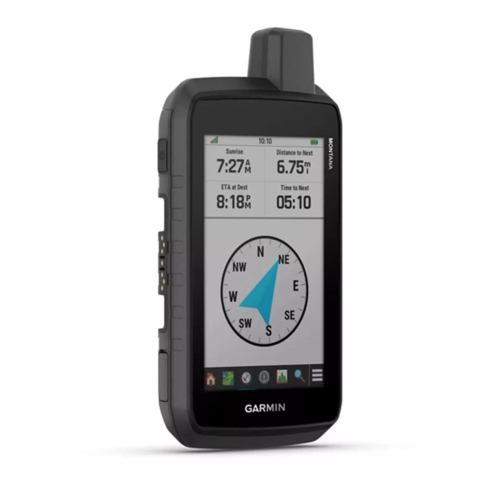
RUGGED GPS TOUCHSCREEN NAVIGATOR
With routable mapping for roads and trails, the Montana 710 handheld brings advanced outdoor features into a sturdy 5-inch format thats ideal for navigation on foot, bike, kayak, ATV and more.
WHAT YOU’LL LOVE
- Rugged by DesignThis durable, water-resistant handheld has been tested to meet MIL-STD 810 for thermal shock, water, and vibration. It features a glove-friendly 5-inch touchscreen and is compatible with a variety of robust mounting solutions (sold separately) to best suit your activities.
- Topoactive MapsTo navigate your adventures, use preloaded worldwide topographical maps. View terrain contours, elevations, coastlines, rivers, landmarks and more.
- Satellite ViewsAccess subscription-free, high- resolution satellite imagery with direct-to-device downloads over Wi-Fi connectivity. See photorealistic overhead views of routes and surrounding terrain, and easily create waypoints based on landmarks.
- Additional MapsWith 32 GB of onboard memory, you can download even more maps, such as City Navigator maps for your drive or BlueChart g3 charts for the water (sold separately).
- Outdoor Maps+With a subscription to Outdoor Maps+ (sold separately), get ongoing access to a wide variety of premium mapping content and regular updates sent right to your Garmin device via Wi-Fi technology.
- Garmin Explore AppPair with the Garmin Explore app to plan and review trip data, plus manage your waypoints.
NAVIGATION FEATURES
- Multi-GNSSSupportAccess to GPS and Galileo satellite networks enables Montana 710 to track in more challenging environments than GPS alone.
- ABC SensorsNavigate your next trail with ABC sensors, including an altimeter for elevation data, A barometer to monitor weather and 3 -axis electronic compass.
- Active WeatherAccess up-to-date active weather forecasts via the Garmin Connect app on your compatible smartphone.
- Dog TrackingFor hunters and trainers, this Montana handheld syncs with your compatible Astro or Alpha series handhelds to help track sporting dogs in the field.
- WikiLoc TrailsThis preloaded app lets you easily download hiking, cycling and other Wikiloc trails shared by outdoor enthusiasts like you. Get a free 60-day Wikiloc Premium trial to try this and other exclusive features.
ADVENTURE FEATURES
- Public Land BoundariesOptional display of federal public land boundaries on topographical maps helps you know that youre venturing where youre supposed to be.
- Expedition ModeTrek far and wide off-grid. Use expedition mode, an ultralow-powered GPS reference, to keep Montana tracking for more than 2 weeks between recharges.
- Battery OptionsA rechargeable lithium-ion battery pack provides up to 24 hours of battery life in GPS mode and charges with a standard USB-C cable. It can also be powered with traditional AA batteries (not included).
- Vehicle MountsA variety of Montana handheld- compatible mounts (sold separately) lets you adapt your navigator for use on ATVs, boats, cars, motorcycles, RVs or other vehicles.
Compatible Products:
- Outdoor Maps+ Annual Plan
- inReach Mini 2
- inReach Messenger Plus
- inReach Messenger
- Bicycle Handlebar Mount
- Suction Cup Mount with Speaker

 No products in the cart.